Discover Sutton
History
A brief history of Sutton
Geography
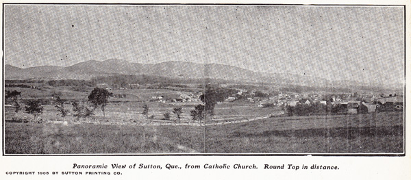
Panoramic view of Sutton from the Catholic church.
The town of Sutton spans an area of some 247,67 km2, bound to the north by the towns of Brome Lake and Brome, to the south by the U.S. border and to the east and west by the townships of Potton and Dunham, respectively. This large, squarish territory contains distinctive zones: the west, at the foot of the mountains, is primarily farmland; the southeast is a valley through which the Sutton River flows; and the east is a mountain massif, the northern extension of Vermont’s Green Mountains. Dominated by Round Top, which has an elevation of 962 m, this mountainous area offers many recreational activities: downhill and cross-country skiing, snowshoeing, treetop adventure courses and hiking.
The geographic centre of the territory is also the most densely populated area, and encompasses two hamlets: Sutton Junction to the north and Glen Sutton to the south, in the Missisquoi River Valley.
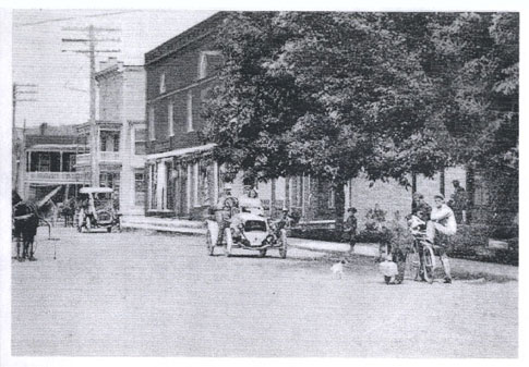
The corner of Principale and Maple in the early 20th century. On the right is the Olmstead and Boright store (today it is Au Rendez-vous de la mode). On the opposite side of Maple is the clinic and drug store of Dr. Frederick Cutter Jr.
The first inhabitants
Thousands of years ago, Aboriginal peoples inhabited the area of Sutton. Archaeological sites near Missisquoi Bay and near Glen Sutton. Closer to us, Sutton was a hunting, fishing and food-gathering area for the Western Abenakis, coming from Vermont and Odanak. John Collins, the first person to survey the region, reported the presence of members of that tribe between 1771 and 1774.
The pioneers
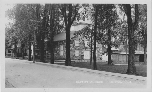
Olivet Baptist Church circa 1910
The boundaries of Sutton township were defined in 1792 by surveyor Jesse Pennoyer, who placed survey markers at the four corners of a 16-km (10-mile) square. He also divided the lands in 308 lots. The official history of Sutton’s colonization begins in 1802 with the concession of most of the lots divided by Jesse Pennoyer (approximately 200 acres each) to some 168 concession holders. In addition, at the time, the church and the king each received 1 in 7 lots. However, many colonists had already settled in those territories some years before. Some of them had fled the U.S. after the American Revolution (1776–1783), as England offered to welcome its loyalists to Canada, at that time one of its colonies. Others had simply migrated north in search of affordable land.
Some of these squatters received concessions in 1802. Among them were Thomas Spencer and Alexander Griggs, who left New York State in 1792 to settle in Abercorn; Joseph Soles from Rhode Island, who settled in North Sutton in 1795; Moses Westover, who came from Massachusetts in 1796 and built a house not far from the intersection of Mont-Écho and Élie; and William Marsh, who, as early as 1797, was living in the heart of what is now the core of Sutton, known for a long time as Sutton Flat.
The first mill
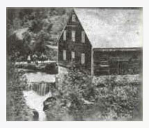
The mill built on the Sutton River by Lagrange around 1840. The waterfall is located slightly upstream of what is now Highland Street.
Thomas Shepard of New Hampshire arrived in Abercorn in 1792 and built the first flour mill in what was then the Township of Sutton. The hamlet around the mill was named Shepard's Mills until the opening of the post office in 1848 named Abercorn.
The hamlet of Glen Sutton also has a long history. Among the first to settle there was James Miller, who arrived in 1799, followed by Theophilus Hastings and Benjamin Burnett in 1800. All three came from Vermont.
First named Dodge, from the name of the tavern located at the south end of Bridge Street, the town was renamed Glen Sutton in 1861, following a suggestion from James Moir Ferres, a Scotsman who was a member of Parliament for Brome from 1858 to 1861. Glen means “little valley” in Scottish Gaelic.
Demographic changes
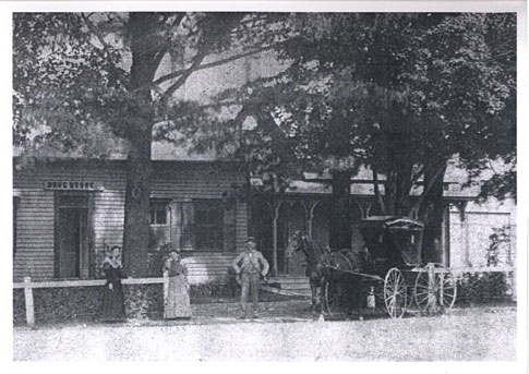
Dr. Frederick Cutter Sr.'s drug store adjacent to his house, at the intersection of Academy and Principale North (northeast corner).
The first census dates was taken in 1803. At the time, the population of the Township of Sutton totalled 500 inhabitants, of whom 101 were land owners, 82 were married men, 15 were single men and 4 were women. In 1832, the population had only reached 825. It must be said that the harsh cold of 1816 had discouraged many. That year, six inches of snow fell on June 6-8, and there were no months that did not experience hard frosts. With the loss of the harvest, hunger and poverty led many young people to leave and settle in Upper Canada (now Ontario).
The first French-speaking settlers arrived at the end of the 1830s, as good land was scarce in the seigneuries along the Saint Lawrence and Richelieu rivers. Their names were Dubé, Gendron, Godue, Lusignan and Métivier. The first French-speaker to hold an official position in the municipality was Baptiste Saint-Pierre (whose name has often been distorted and written: Battesse Sampier). Already a resident of Sutton in 1846 (according to the assessment roll), he was appointed appraiser and controller in 1858.
The town organizes itself
Following the rebellion of 1837–1838, the British parliament passed the Union Act, which united Upper Canada and Lower Canada under one government. The new assembly of United Canada then set up the legislative framework allowing for the creation of town councils. During its first meeting, on July 21, 1845, the council of the Township of Sutton elected Moses Westover as mayor and George C. Dyer as secretary-treasurer. Ten years later, on July 1, 1855, the Township of Sutton became an incorporated municipality. The need for a town hall soon became apparent. W. M. Dow drew up the plans at the cost of $1,650. The construction of the town hall, entrusted to Alden Olmstead, began in 1859. In 1912, the building’s facade was renovated. The bill came to $5,000 and was split between the Township of Sutton ($3,000) and the Town of Sutton ($2,000). In 1896, the more densely populated area became a separate municipality. By the end of the 19th century, the disparity in the needs for services in rural and urban areas prompted many municipalities to split up into towns and rural municipalities (or parishes). In Sutton, the building of the water system seems to have precipitated the separation. Frédérick A. Olmstead was the first mayor of the new Town of Sutton and Charles Ulric R. Tarte its new secretary-treasurer. In 1929, Abercorn also became an independent municipality, separate from the Township of Sutton, which lost a part of its territory as a result.
The end of isolation
The mountains that give Sutton its beauty actually hindered its development for a long time due to the lack of roads linking it to the rest of Quebec and Canada. Communication was easier to the south, with the U.S., especially since the first customs station only opened in 1848, in Abercorn. A stagecoach service linking Saint-Jean‑sur-le-Richelieu to Troy, Vermont by way of Sutton was started soon after. This also marked the beginning of postal services. The first post office, named Alva, opened its doors at the Frary House, at the corner of Pinacle West and Route 139. Gilbert Fray was appointed postmaster in 1841.
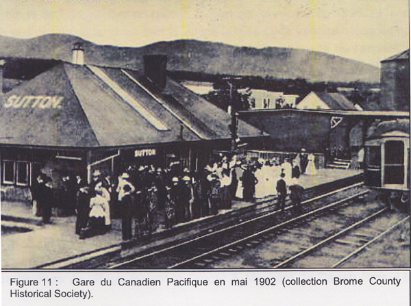
Figure 11: Canadian Pacific Train Station in May 1902 (Brome County Historical Society collection)
The Great Fire of 1898
At 3 a.m. on April 25, 1898, the bell of the Methodist Church rang out: a fire had started at Sutton Lumber, located south of Maple Street, on the banks of the Sutton River. Confident that they had put out the fire and stopped it from spreading, the men who fought the flames returned home at dawn. The alarm sounded again at 7 a.m.: Dr. Macdonald’s barn, on the corner of Pleasant and Mountain (now Maple), was now on fire. Blown by the wind, sparks from the first fire set some bales of hay ablaze, and the fire quickly spread. The villagers mobilized, but the wind, lack of water — the private water system that supplied the village could not meet the demand — and a lack of coordination hindered their work.
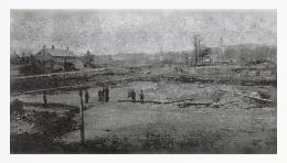
A scene of devastation the day after the Great Fire of 1898. Photograph taken by Frank Wheeler of Richford, Vermont.
In the end, the residents of Knowlton and firefighters of Richford were called in to help and came by train in record time. Around 10 p.m., Saint-Jean’s firefighters also arrived, on the specially chartered Canadian Pacific train — but it was too late. In a few hours, the fire had destroyed everything between Boright Street (now Dépôt), Dépôt Street (now Pine), Pleasant Street and Railway Square, where the railway station used to be. The fire spared the Methodist and Baptist churches.
In the aftermath of these tragic events, the municipal council of the Town of Sutton created a volunteer fire service and on May 23, 1898 adopted Bylaw 6, which decreed the installation of a water supply system. In 1938, thanks to the acquisition of a pump truck (on display at the museum), the rural sector of Sutton, which was not serviced by town water, now benefited from fire protection. A close collaboration between the Town and Township of Sutton developed regarding the administration and funding of the fire service.
The international bridge
Several bridges were built in the Township between 1918 and 1928, including the International Bridge on the Missisquoi River linking Glen Sutton to East Richford, Vermont. This bridge, along with 45 other bridges in the Missisquoi Valley, was destroyed during the Great Flood of November 1927 — the most devastating in Sutton’s history. This bridge, of which 80% belongs to the Americans, was rebuilt in 1929 and completely renovated in 2018. In the U.S., it is listed as a cultural property on the National Register of Historic Places.
Militias and soldiers
As a border town, Sutton has maintained volunteer militias throughout its history to defend the Canadian-American border. Sutton’s militias were particularly active during the Fenian raids of 1866 and 1870, in Frelighsburg and Saint-Armand. Many Suttonites also took part in the World Wars. Thirty-eight lost their lives. Their names are inscribed on a bronze plaque in front of town hall, and town hall’s clock tower, built in 1949 by the Junior Girls Institute, honours their memory.
A change in vocation
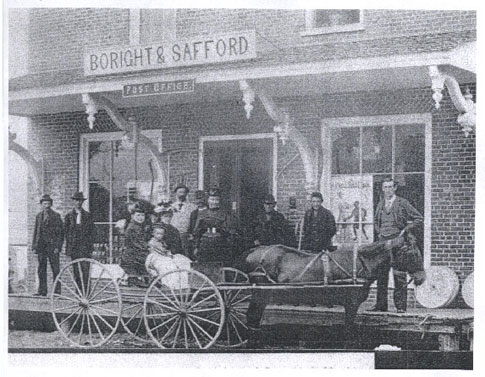
The Boright & Safford store, which also served as a post office, was spared by the Great Fire. The building was built in 1861 and is now home to La Rumeur affamée.
The Boright & Safford store, which also served as a post office, was spared by the Great Fire. The building was built in 1861 and is now home to La Rumeur affamée.
The Great Depression, triggered by the New York stock market crash of October 1929, was felt locally. Economic growth was slow throughout the 1930s, and many farmers experienced difficulties, which, combined with the mechanization of farm equipment, took their toll. (It should be noted that on mountainous terrain, mechanization makes farming more difficult than with horse-drawn equipment.) Many farms were put up for sale. The development of the Mont Sutton ski resort in 1960 marked the beginning of a new economic boom.
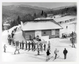
The Mont Sutton ski resort quickly became popular thanks to its many trails through the forest.
Harold Boulanger first came to Sutton to operate the Sutton Dairy Creamery, which he had just bought with two partners and later renamed Les Produits laitiers Sutton. Later, with the help of his sons, he decided to develop the mountain’s recreational potential, thereby opening up the region to tourism. Housing and hotel projects multiplied at the foot of the slopes, forcing the Township to build sewer and water supply systems in 1984. The first sewer system was connected to the Town’s system, and then a new sewage treatment plant was built jointly by the two municipalities. In the heart of the town, stores, shops, galleries and various services appeared.
Farming continued to decline, and a lot of land was bought by city dwellers in search of vacation homes or quiet places to retire. A tourism and convention office was created in 1980. Today, the Corporation de développement économique de Sutton (CDES) manages the Tourist Information Office with the financial help of the Town of Sutton, which, as of 2002, comprises the Township of Sutton and the old Town of Sutton.
To add to your experience and learn more about Sutton history, visit the Museum of Communications and History of Sutton and contact:
Museum of Communications and History of Sutton
The Heritage Sutton Historical Society regularly publishes its History sketchbooks which are sold on line and in several places in the village, including the Tourist Office.

