Installation of geolocation beacons in the Sutton trails
From now on, hikers or cyclists in distress on a trail who call 9-1-1 can be immediately located if they communicate the number indicated on the beacon closest to them (orange triangle). New signs have in fact been installed by the Sutton Fire Safety Service in collaboration with the trail partners along the PENS and Plein air Sutton trails and, in part, the trails in the Eastern Townships including Mont-Echo. Each beacon number is linked to pre-recorded GPS coordinates which will allow the 9-1-1 services to immediately send the exact location to the firefighters sent on a rescue mission to the injured or lost person. “Sometimes, the people who call us do not really know where they are and their explanations are very vague, explains Marc-Antoine Fortier, captain in prevention and logistics of the Sutton Fire Safety Service. This geolocation will save us a lot of time and will allow us to work more efficiently.” This beacon installation project was funded by the Brome-Missisquoi MRC as part of a geolocation plan for trails across the territory. This new tool will help our firefighters improve the safety year-round of hikers and mountain bikers who frequent our trails. Nevertheless, remember that vigilance and being well prepared are just as important elements of safety. At all times, each trail user must: Have enough water and food for the day. Check the weather conditions. Have clothing appropriate to the temperature and a minimum of survival equipment. Have good hiking shoes for walkers. Carry a flashlight with spare batteries. Make…
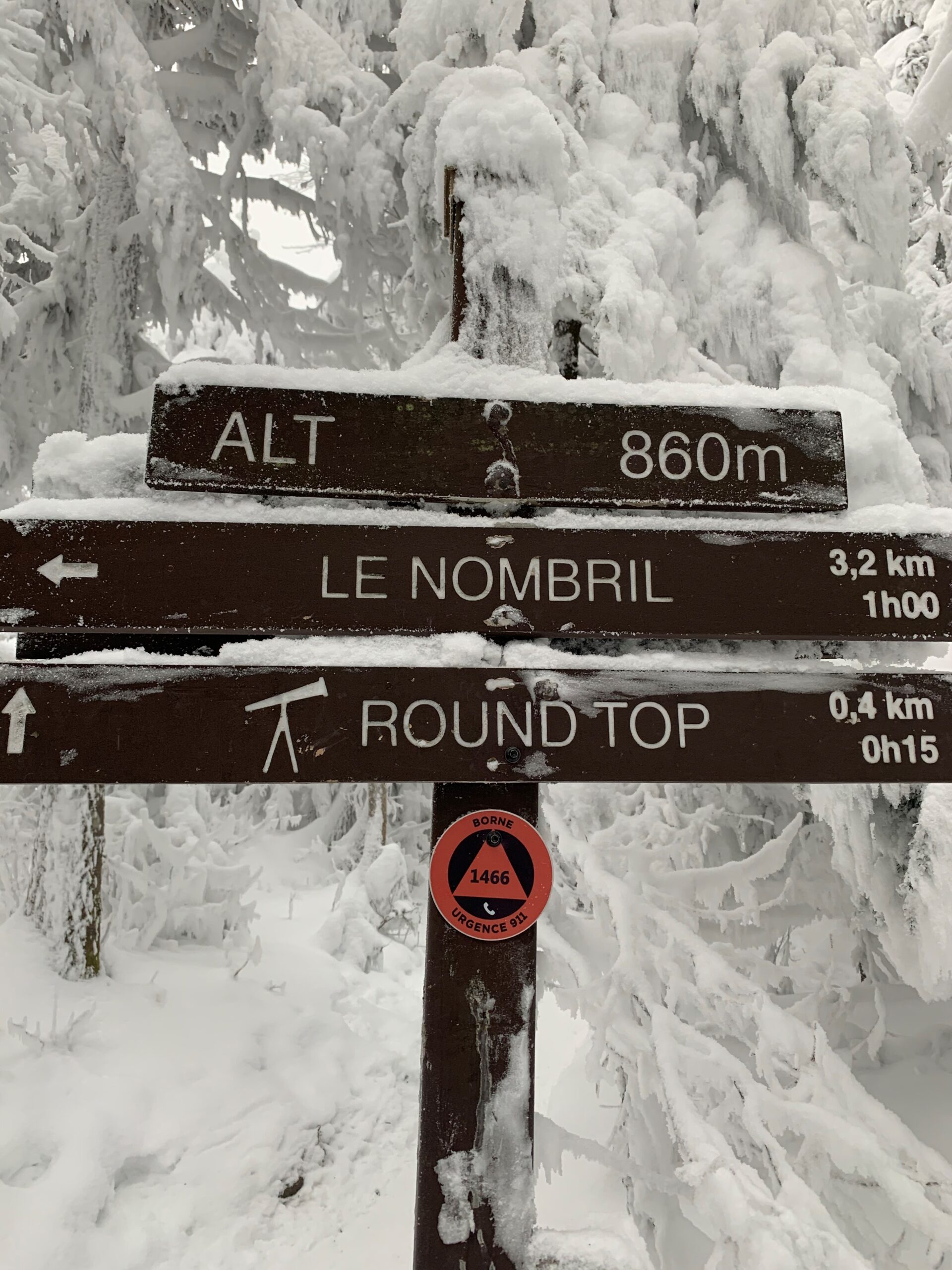
From now on, hikers or cyclists in distress on a trail who call 9-1-1 can be immediately located if they communicate the number indicated on the beacon closest to them (orange triangle). New signs have in fact been installed by the Sutton Fire Safety Service in collaboration with the trail partners along the PENS and Plein air Sutton trails and, in part, the trails in the Eastern Townships including Mont-Echo. Each beacon number is linked to pre-recorded GPS coordinates which will allow the 9-1-1 services to immediately send the exact location to the firefighters sent on a rescue mission to the injured or lost person. “Sometimes, the people who call us do not really know where they are and their explanations are very vague, explains Marc-Antoine Fortier, captain in prevention and logistics of the Sutton Fire Safety Service. This geolocation will save us a lot of time and will allow us to work more efficiently.”
This beacon installation project was funded by the Brome-Missisquoi MRC as part of a geolocation plan for trails across the territory.
This new tool will help our firefighters improve the safety year-round of hikers and mountain bikers who frequent our trails. Nevertheless, remember that vigilance and being well prepared are just as important elements of safety.
At all times, each trail user must:
- Have enough water and food for the day.
- Check the weather conditions.
- Have clothing appropriate to the temperature and a minimum of survival equipment.
- Have good hiking shoes for walkers.
- Carry a flashlight with spare batteries.
- Make sure, if applicable, that their cell phone is fully charged and kept warm.
- Choose a course suited to their physical condition.
- Stay on marked trails, as much for one own safety as to preserve the surrounding nature.
For more advice on winter hiking preparation and safety, visit the Rando Québec website (in French only).